Original file (1,287 × 2,567 pixels, file size: 6.91 MB, MIME type: image/png)
Summary
| Description |
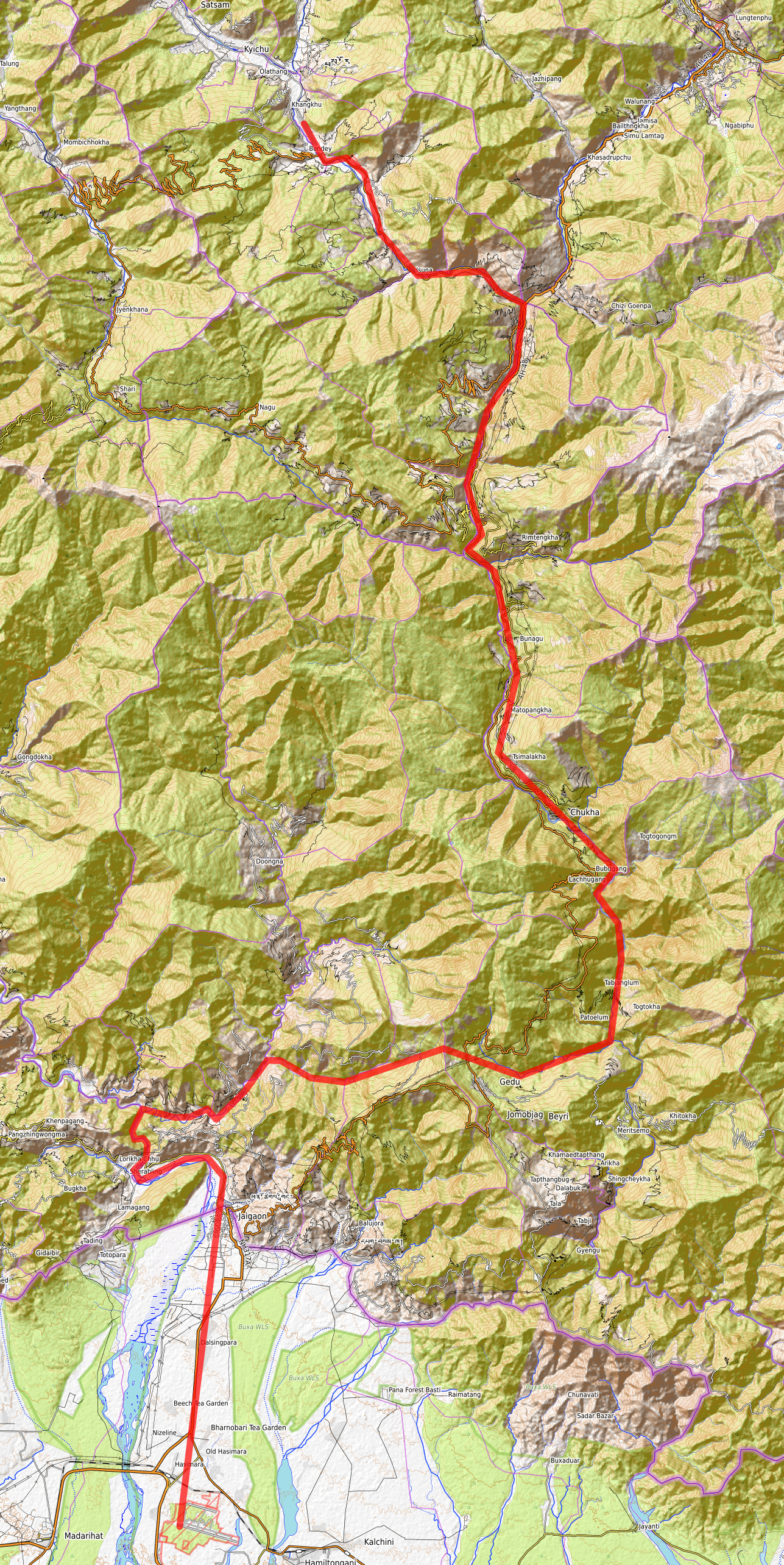
(en) The route to follow in the maze of valleys between Hashimara Air Base (VE44) and Paro airport (VQPR). Created using OpenStreetMap and the Open Topo layer. |
| Date |
23 August 2024
(2024-08-23) |
| Source |
Own work |
| Author |
Ludovic Brenta |
Licensing
I, the copyright holder of this work, hereby publish it under the following license:

 
|
This file is licensed under the Creative Commons Attribution-Share Alike 4.0 International license.
You are free:
- to share – to copy, distribute and transmit the work
- to remix – to adapt the work
Under the following conditions:
- attribution – You must attribute the work in the manner specified by the author or licensor (but not in any way that suggests that they endorse you or your use of the work).
- share alike – If you alter, transform, or build upon this work, you may distribute the resulting work only under the same or similar license to this one.
|
|
|
|
|
File history
Click on a date/time to view the file as it appeared at that time.
| Date/Time | Thumbnail | Dimensions | User | Comment |
|---|
| current | 02:33, 23 August 2024 |  | 1,287 × 2,567 (6.91 MB) | Circumn (talk | contribs) | Uploaded own work with UploadWizard |
You cannot overwrite this file.
File usage
The following page uses this file:
This file contains additional information, probably added from the digital camera or scanner used to create or digitize it.
If the file has been modified from its original state, some details may not fully reflect the modified file.